blah blah blah
Mad River Path
Length: 2.2 mile loopDifficulty (click for info): Easy
Elevation Gain: 190 feet (loop total)
Rating (click for info): 6/10
Driving Directions:
Trailhead and parking area are at the Waterville Valley Town Square, on Village Road. This large resort complex is located just off Rt. 49, 11.1 miles northeast of Exit 28 off I-93. Turn left onto Village Road at the sign for "The Town Square" and drive 0.2 miles into the parking lot and park near the main entrance (look for the crosswalk and canopy-covered walkway). Click here for a Google map.
About the Hike:
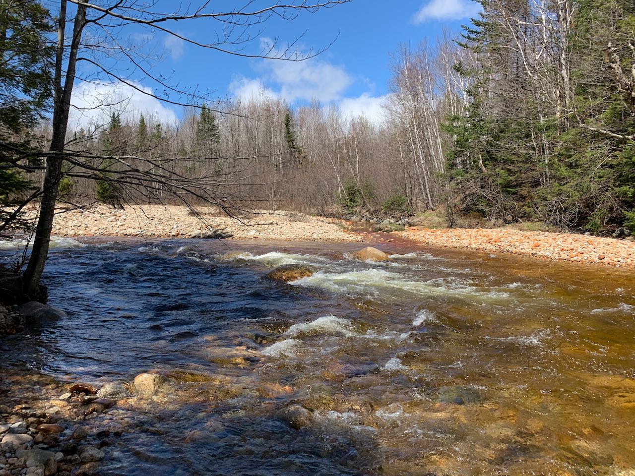
Even in the center of the resort mecca in Waterville Valley, there is an abundant presence of natural beauty. The relatively new Mad River Path offers a quiet ramble along the banks of (you guessed it) the Mad River, while it is still a shallow, stony, and rapid mountain waterway. The well-constructed trail tackles a severe hill beside the river with ease, making use of rock and wood staircases; and it utilizes a row of carefully placed boulders to cross a normally impassable branch of the river. A walk down a series of sidewalks is needed to complete the loop, but it doesn't detract from the experience at all, since there are plenty of mountain views all along the way and even a bit of town history.
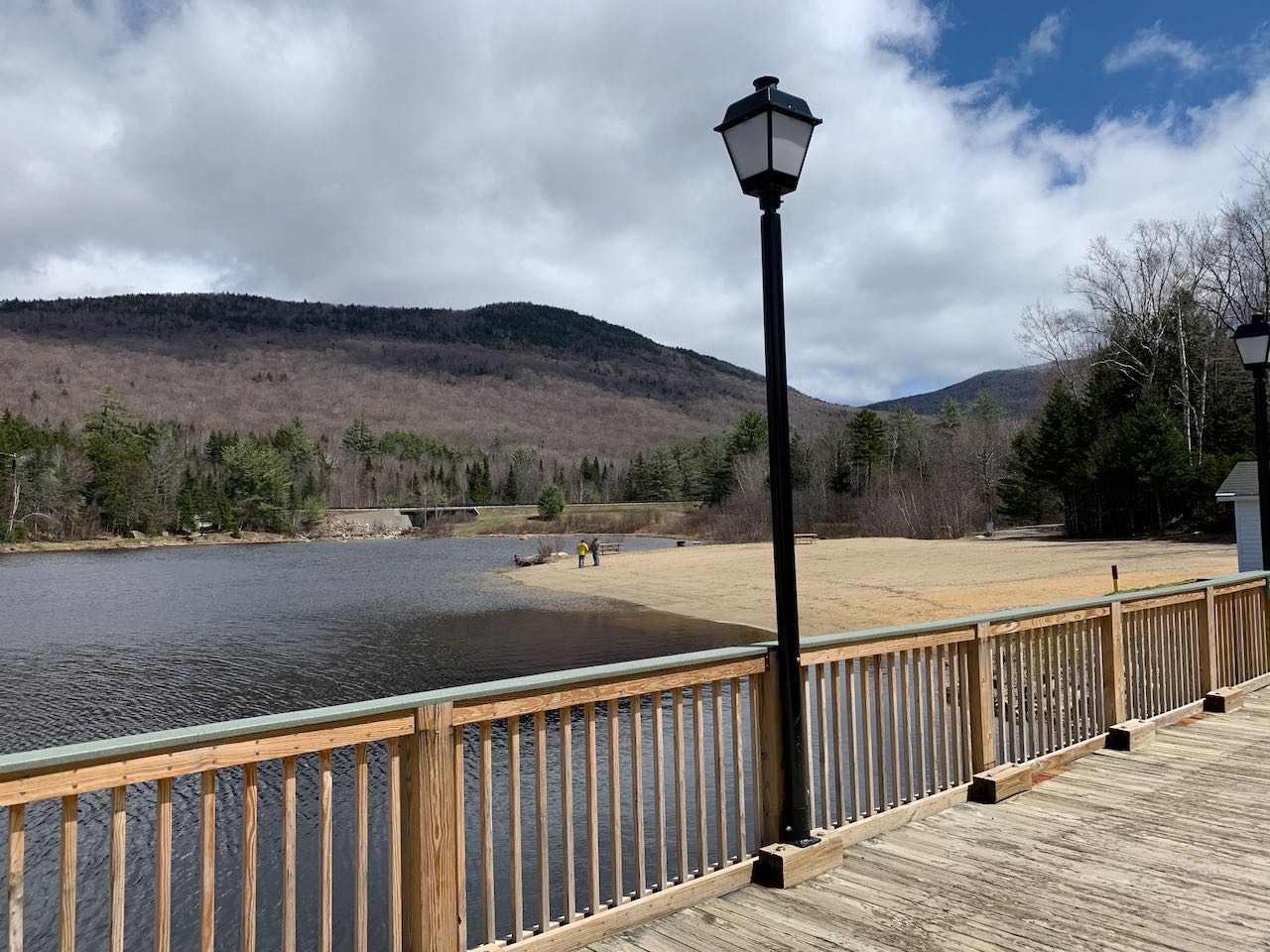
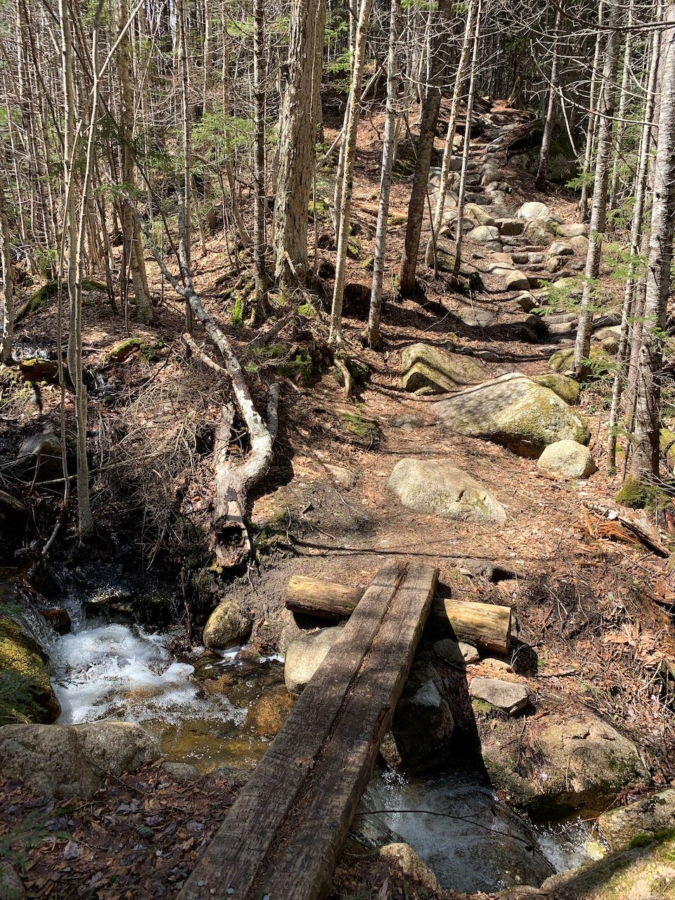
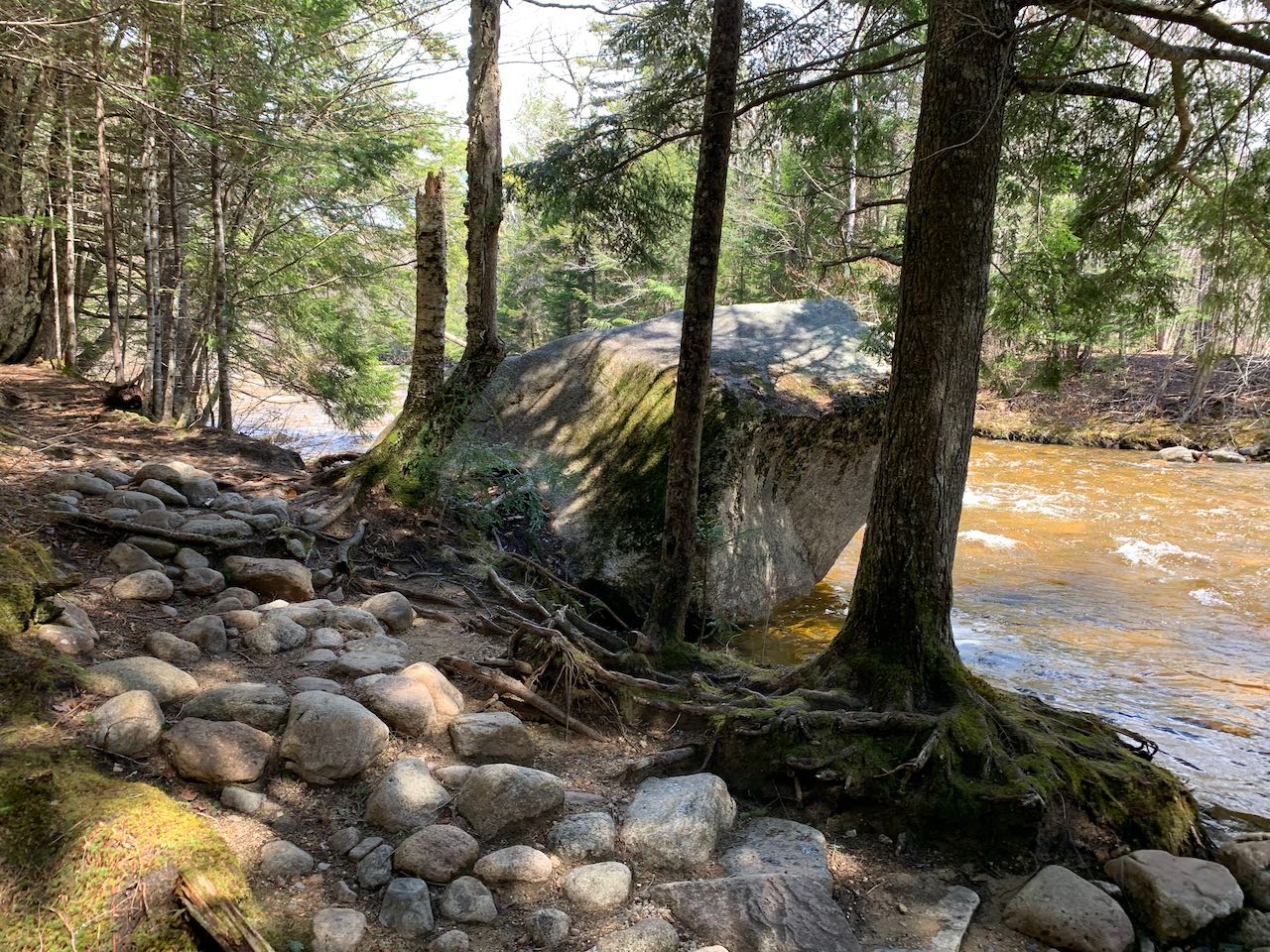
Begin your hike by walking through the entrance into the square. Head over toward Corcoran's Pond and cross the bridge over the dam. On the far side, turn right onto a gravel multi-use trail and follow it alongside Snow's Brook. After a total of a quarter mile, the trail passes beneath a road in an underpass made from a culvert pipe. In another 0.15 miles, turn right and cross the bridge over Snows Brook just above where it merges with the Mad River. Not far beyond, cross a larger bridge over the Mad River itself. On the other side of the bridge, bear right onto the Mad River Path itself as the multi-use trail swings around to the left. Now on a pleasant forest footpath, the trail follows the bank just above the river. It soon crosses a log bridge over a small brook and then climbs a well-built stone staircase. After reaching its high point after 0.2 miles, the trail plummets back down the sharp incline to the river's level on multiple sets of wooden stairs. At the bottom of the hill, the trail crosses a larger brook at its mouth right where it disappears into the foamy river. On the other side, an interesting boulder is situated right over the river. From here, the path follows the flat plain close by the river. It crosses another, more sluggish brook, passes a good resting spot on a grassy opening on the riverside, and reaches a fork a quarter mile from the top of the hill. The right fork is a brief spur path that leads out to a stony area with nice scenery up and down the river where there are large amounts of gravel outwash.
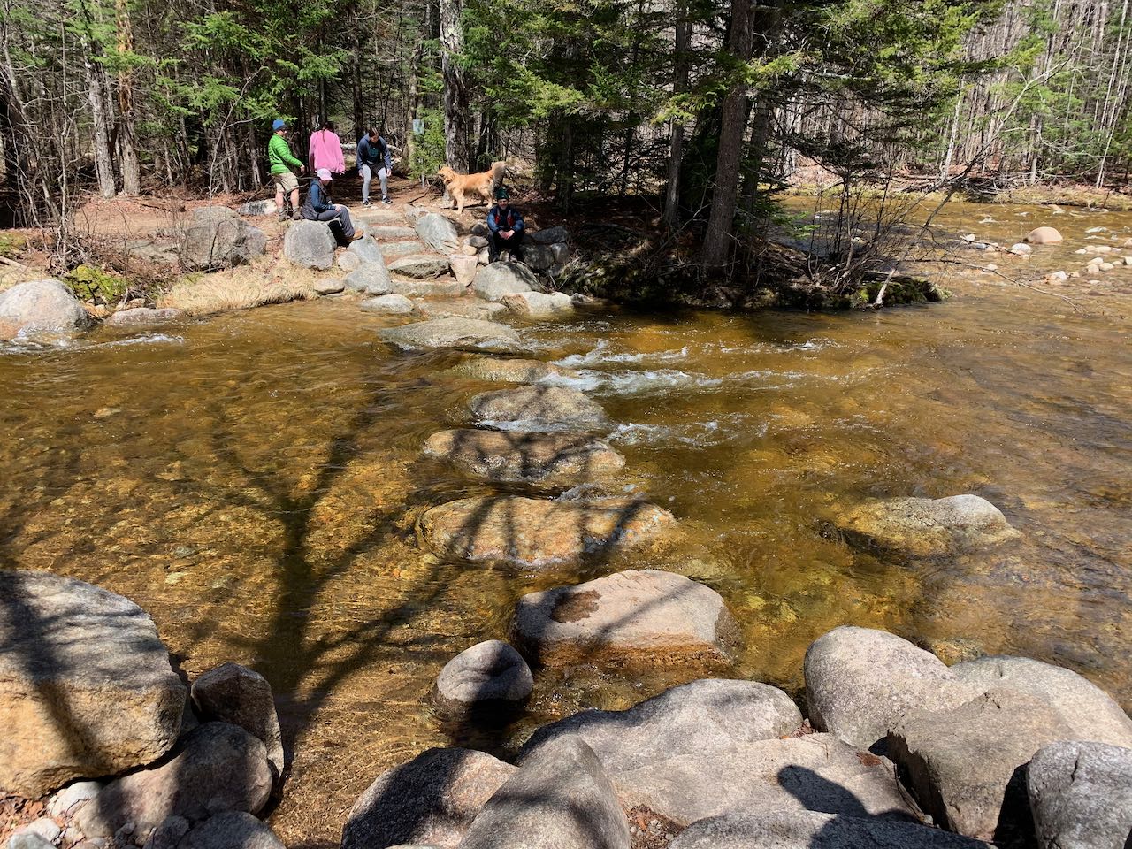
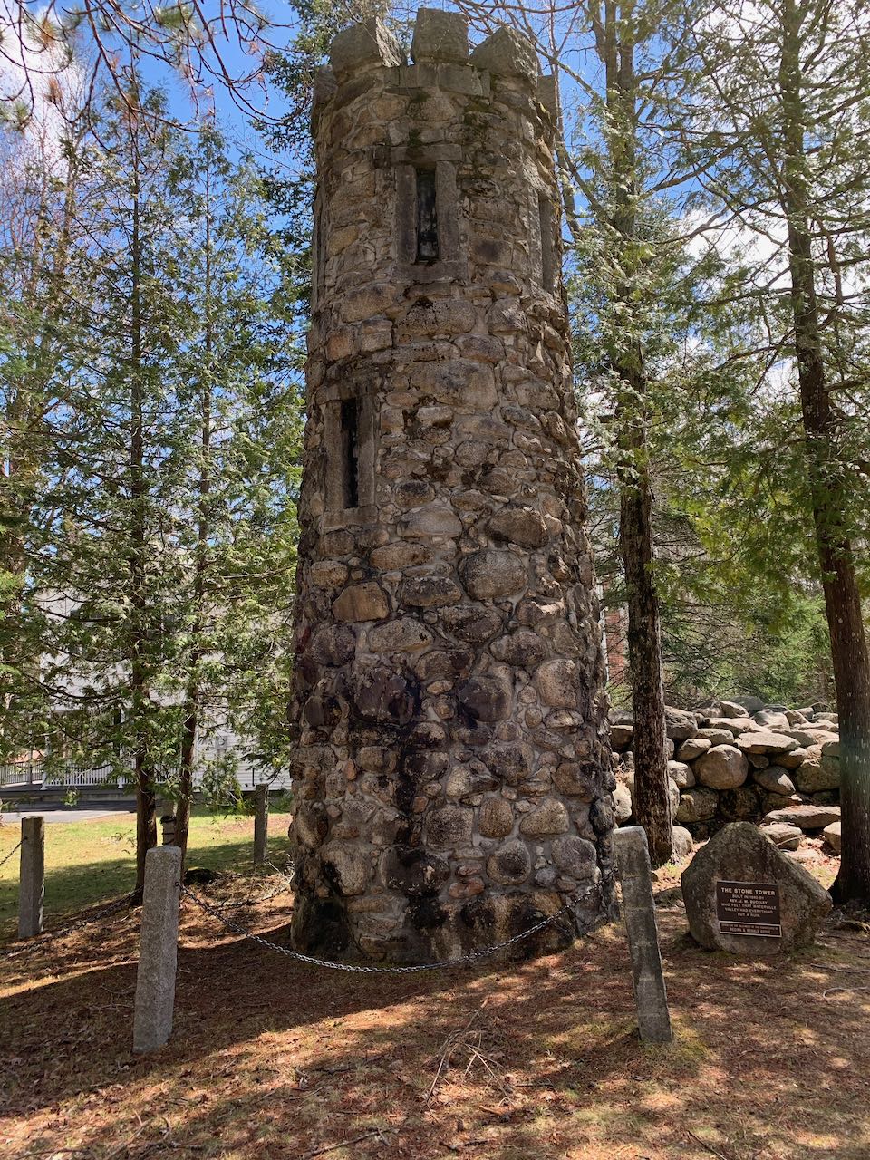
The main trail continues through the woods for 0.1 miles more to where the Mad River's west branch flows in and crosses it on artificially placed rocks that rise just over the water. In high flow conditions, these rocks may be covered over, in which case it is best to simply return the way you came. Otherwise, cross the water and continue on the trail as it leads up the narrow strip of land between the two waterways. It soon joins a dirt road, and after a quarter mile, you will reach the northern end of the trail on West Branch Road. Turn right onto the sidewalk, cross the bridge over the main branch of the river, and follow the road uphill for 0.1 miles. Turn right onto Stone Tower Lane. Walk this road another 0.1 miles out to the main road, passing the eponymous stone tower, which has the humorous history of being built by a resident who wanted his town to have a mysterious castle ruin. Turn right on Boulder Path Road and follow the sidewalk south for 0.35 miles, across from the open fields of the golf course, where Mt. Osceola rises impressively over the trees. At the junction with Rt. 49, cross the crosswalk and continue on the sidewalk for another 0.1 miles to the town square entrance. Turn right the way you drove in and walk the final 0.2 miles back into the parking lot.
Printable directions page